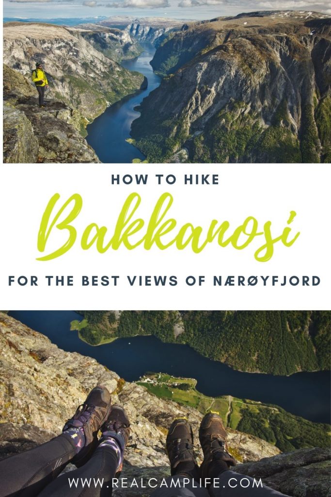
The UNESCO protected Nærøyfjord is a popular stop on the Norway in nutshell route. Many people take a train from Oslo to Flåm, and then they continue with a fjord cruise on the magnificent Aurlandsfjord and dramatic and narrow Nærøyfjord before continuing westwards to Bergen. The steady stream of tourists makes the villages of Flåm and Gudvangen rather crowdy places during the high season. If you want to escape the crowds and experience extraordinary views on the narrow Nærøyfjord then you should definitely put the hike to Bakkanosi on your bucket list.

QUICK FACTS ABOUT HIKING TO BAKKANOSI
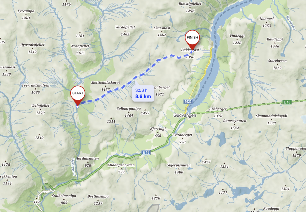
- Distance: 20 km (out‑and‑back)
- Elevation gain: 800 m
- Total time: 6 – 8 hours
- Season: June – October (possible to do it on skies over the winter)
- Difficulty: Demanding
- Starting point: Old school at Jordalen (click here for directions)
- Weather forecast: Bakkanosi weather forecast
- Map: Nærøyfjorden 1:50 000 of offline version of Norgeskart
HOW TO GET TO THE TRAILHEAD TO BAKKANOSI
The hike to Bakkanosi starts at the old school builiding in Jordalen valley. Follow the E16 from Gudvangen towards Voss and after about 10 km turn right towards Jordalen. After the tunnel continue for about 3 km until you arrive to a small parking area.
The parking right next to the old school building costs 70 NOK and is paid by VIPPS. (Vipps is a Norwegian mobile payment application that works only for norwegian phone numbers. For people who do not have norwegian phone numbers there would normally be a box where you could put the money, but I haven´t seen anything like that there. Try to look around.)
Be aware that there is no phone signal, so even if you have vipps it is not gonna work right on the spot.
HIKING BAKKANOSI
The hike to Bakkanosi is not marked but for most of the time it is quite obvious. If you are using the norgeskart do not forget to download the map since there is no mobile phone connection.
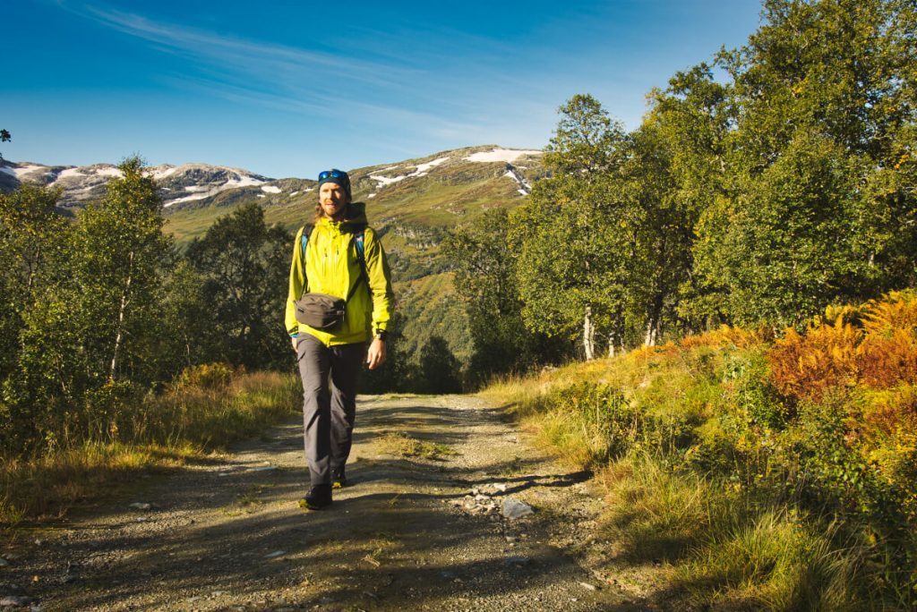
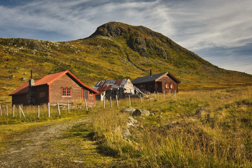
After you park the car at Jordalen school, cross the small bridge and right after the bridge turn right and follow the tractor road up the hill. The road continues for about 3 km and climbs about 300 m up until you reach a summer farm in Slettedalen valley.
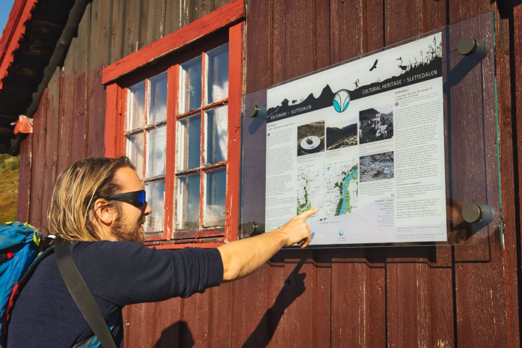
Summer pastures in Slettedalen
In Norway there is a long history of farmers having farms called “sæter” high up in the mountain valleys where the animals could graze during the summer months. The summer pastures were usually quite far from the villages so the milkmaids were staying at the summer farms for extended periods of time.
The traditional mountain farming in Slettedalen lasted until the 1980s. There are however still grazing animals in the valley so be respectful and do not forget to close all the gates behind you.
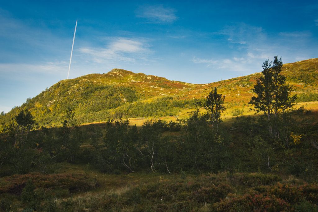
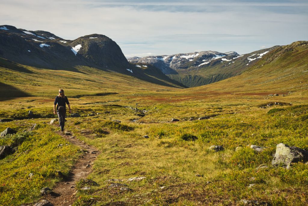
Hiking up the Slettedalen valley
After the farm houses the path significantly narrows and follows the river further up the valley. The terrain is flat and reasonably dry but when we hiked there there were a few muddy sections where we really appreciated our waterproof socks. Stay on the left shore of the river and continue up the hill towards a small lake called Slettedalstjørni.
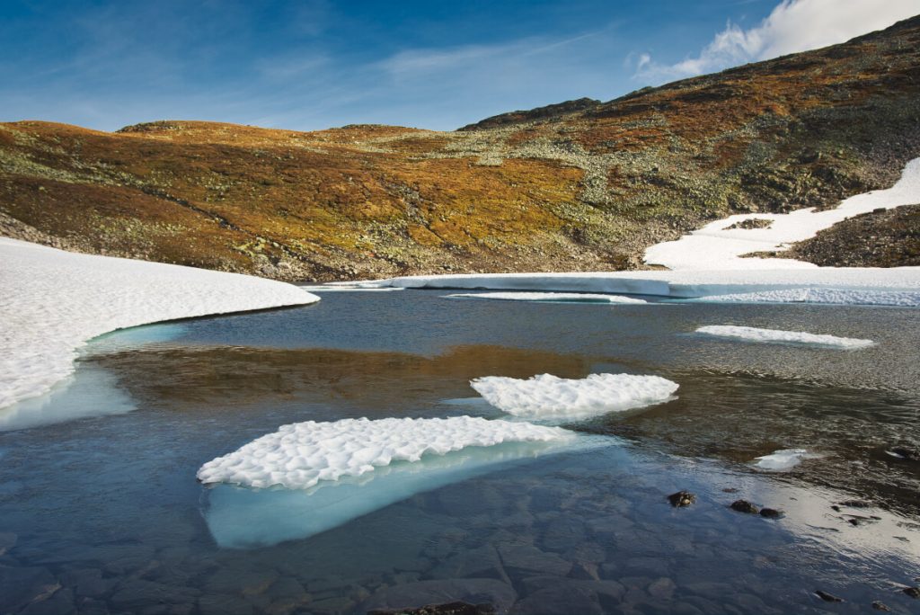
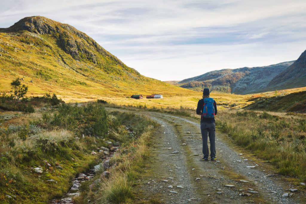
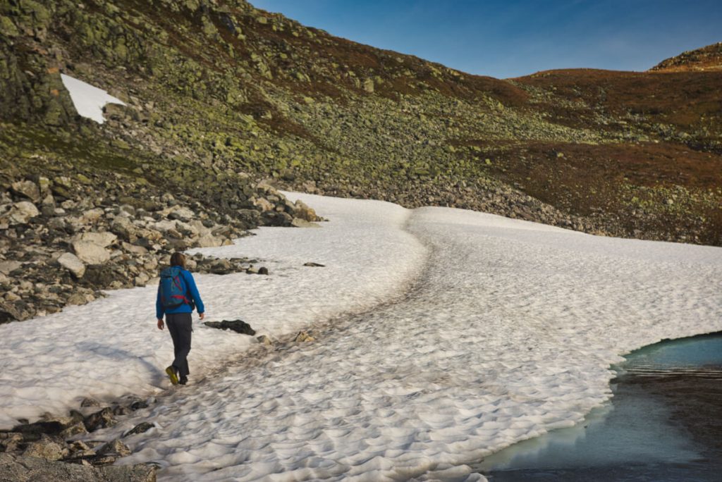
Cross the lake on the left side and continue hiking up the hill along a smaller stream to Lyngskaret. There the terrain narrows down again and you will get a first glimpse of the Nærøyfjord and parts of the Rimstigen trail that climbs up from to Rimstigfjellet and Breiskrednosi all the way from the farm Tufto that lies at the shore of the Nærøyfjord.
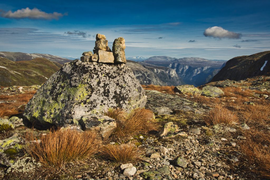
Last stretch to Bakkanosi
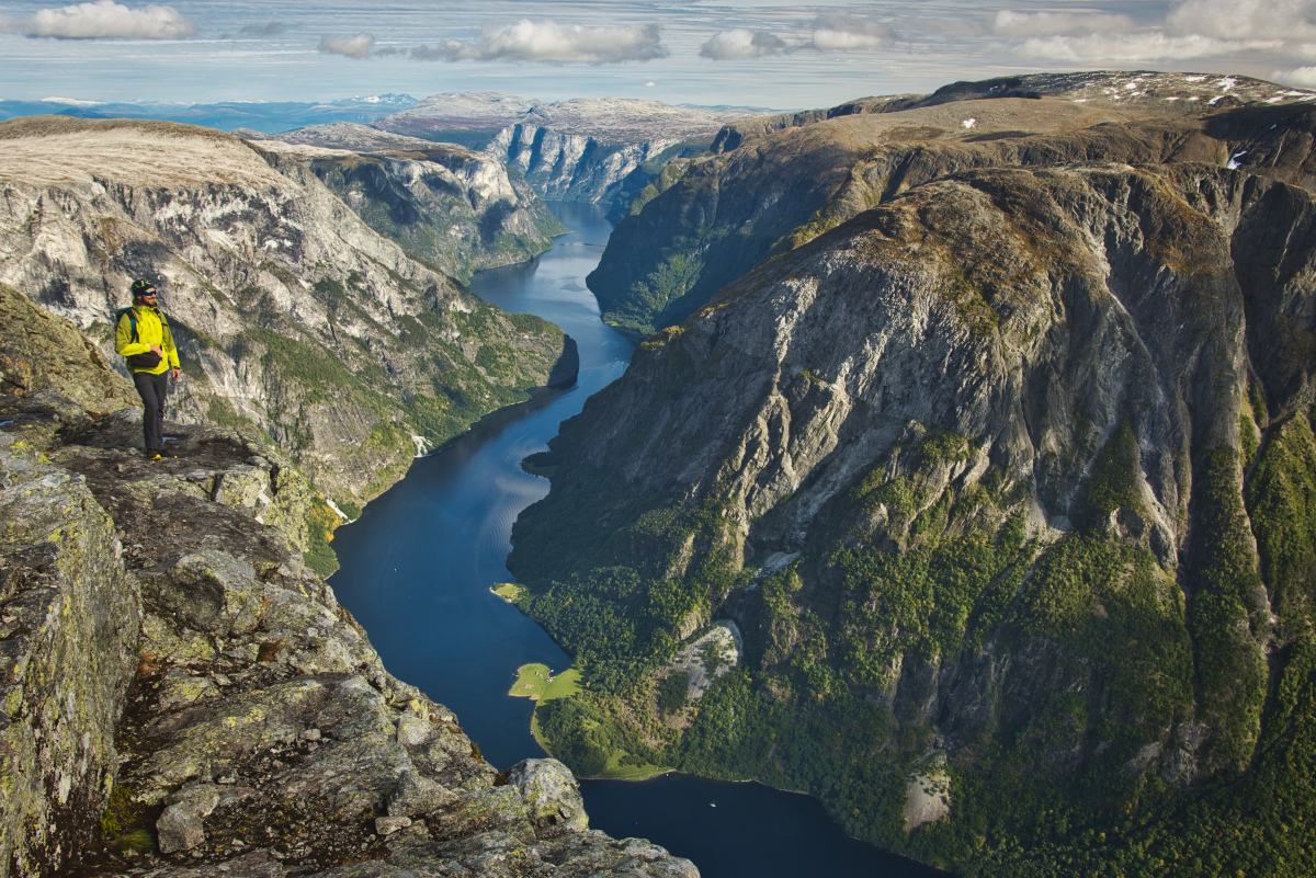
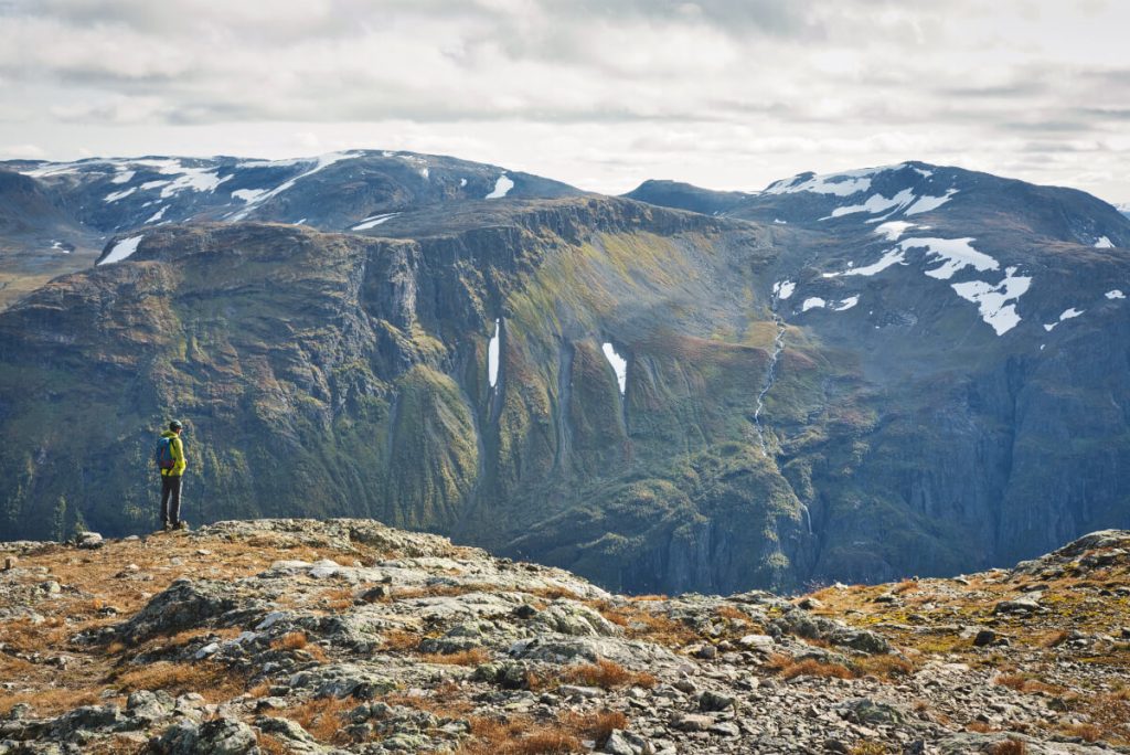
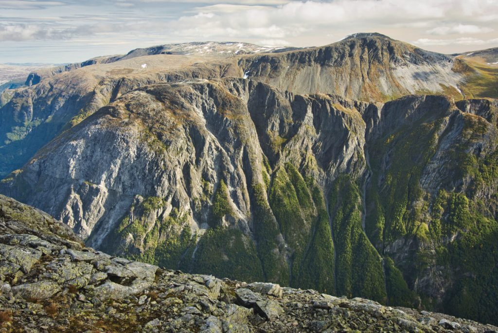
From the plateau you can already see the Bakkanosi ridge on your right side. Try to follow the stone cairns that are showing the way. It is no problem when the weather is nice but be careful – the top of Bakkanosi is a rather flat plateau and at its end there is 1300 meters long drop straight down to the fjord.
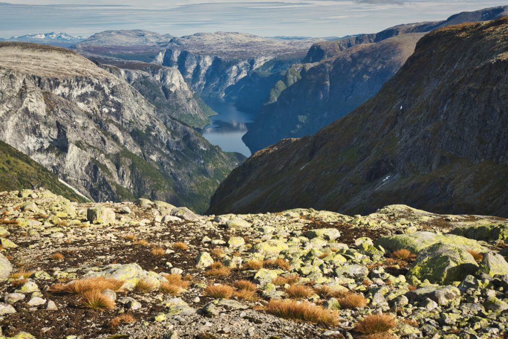
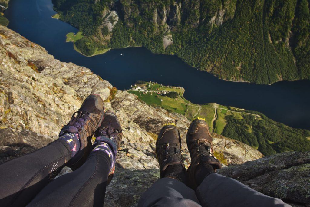
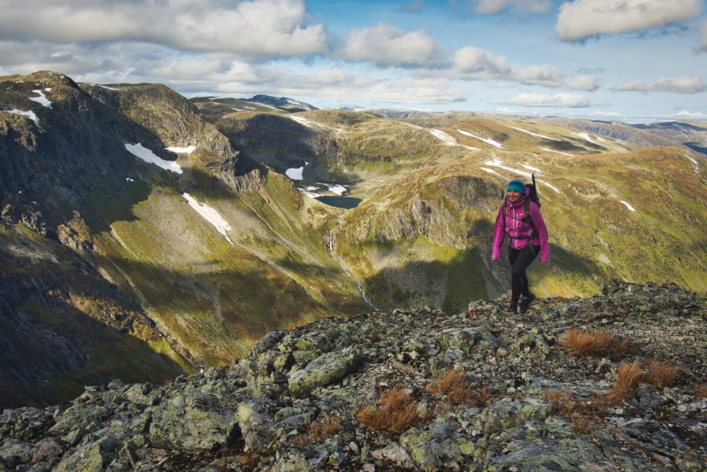
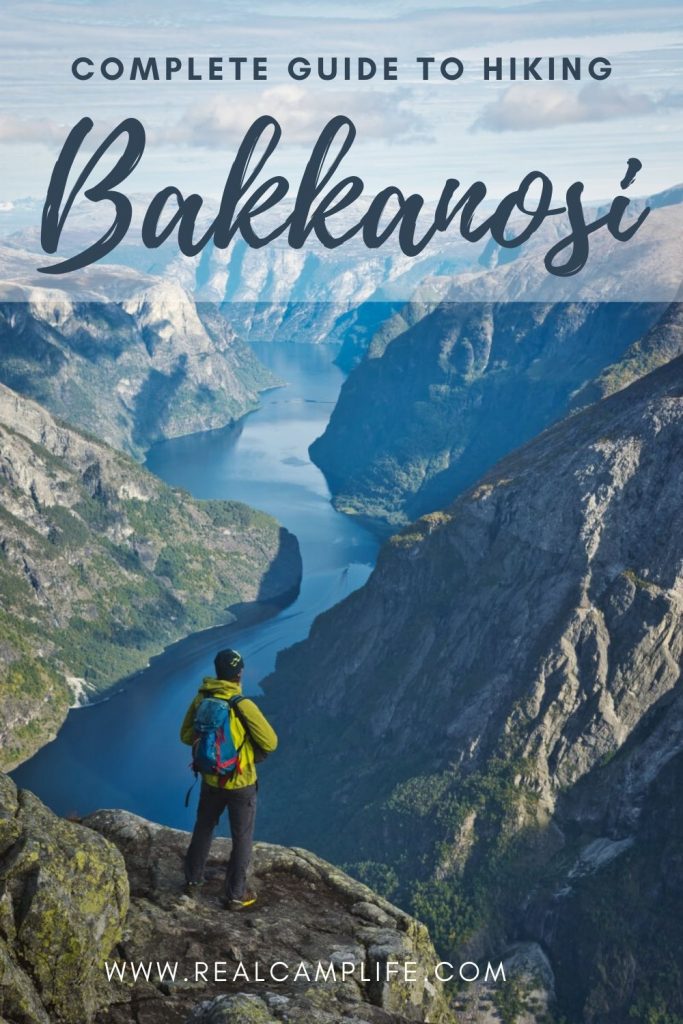
The view from Bakkanosi is simply breathtaking. You can see the gentle swings of the 18 km long and sometimes only 250 m wide Nærøyfjord under you. The high mountains with steep cliffs surrounding the fjord aren´t any less spectatular. On the days with a good visibility you can even see the peaks of Jotunheimen – Norway´s highest mountain range. We could sit there on the edge of the cliff, swing our legs in the air and watch the landscape for hours.

BAKKANOSI HIKE MAP
CAMPING AND ACCOMMODATION OPTIONS CLOSE TO BAKKANOSI
Wild camping
In Norway it is allowed to camp in the wild. You should pitch your tent at least 150 meters away from any inhabited building and do not stay on the same spot for longer than 1-2 nights. Also be aware that during the summer months (April 15 to September 15) it is not allowed to light a fire. You can find more information about wild camping in the article below.
Camping
If you search for a place to spend a night in your car or a van then there is a resting area at E16 right before you turn to Jordalen which has a toilet and running (non potable) water. There is however a campsite close to Gudvangen with a stunning view to Kjelsfossen waterfall that is running down the steep mountain face just across the road.
Hotel stay
If you long for some more comfort then I would recommend staying at Stalheim hotel from where you have an excellent view to the Nærøy Valley. The famous hairpin road – Stalheimskleiva is located right next to the hotel and there also some amazing hiking possibilities. Eg the hike to the Nåli mountain farm.
OTHER INTERESTING HIKES AND ACTIVITIES IN THE NÆRØYFJORD AREA
DID YOU LIKE IT? PIN IT!
Related posts
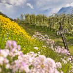
 The Best Thing About Spring in Norway? Fruit Blossoming in Hardanger!
I have always loved spring in Norway. No, not the time when you think that…
- 40 Best Photos From Norway to Inspire Your Next Trip
For the last two years, we were trying to work as much as we could…
- The North Sea Route: Hidden Gem on the Southern Coast of Norway
The North Sea Route (Nordsjøruta) is a road that stretches along the south coast of…