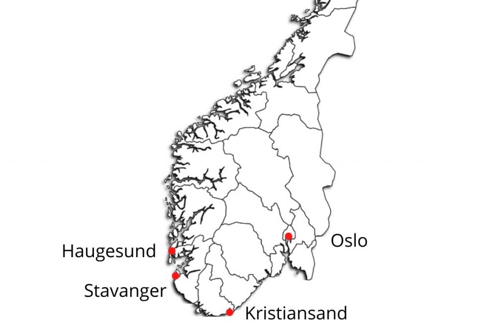
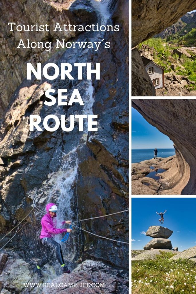
The North Sea Route (Nordsjøruta) is a road that stretches along the south coast of Norway in between Kristiansand and Haugesund. This region is often overlooked by tourists who arrive in Norway by a ferry from Denmark and hurry up to see the famous Preikestolen.
In this article, we want to show you some of the tourists’ attractions along the North Sea Route and perhaps inspire you to give this often underestimated region characterized by idyllic villages, long sandy beaches, and interesting geological formations a chance.
After almost a month at Ivar’s family cabin close to Haugesund, where we spent the quarantine after our sudden return from Argentina we decided that it is about time to hit the road again and go for a proper road trip. We did a couple of day trips from the cabin before because we wanted to see the famous tree blossoming in Hardanger but this time we plan to spend a whole week on the road from Haugesund to Oslo.
The North Sea Route
The North Sea Route is not the shortest way between these two cities. Normally, we would drive the E134 through Haukeli, which takes about 6 hours. But we know that route too well and wanted to explore something new. Because of that and the fact that Ivar has never been to Preikestolen before, we have decided to drive south and explore the area around the little known Nordsjøvegen alias the North Sea Route.
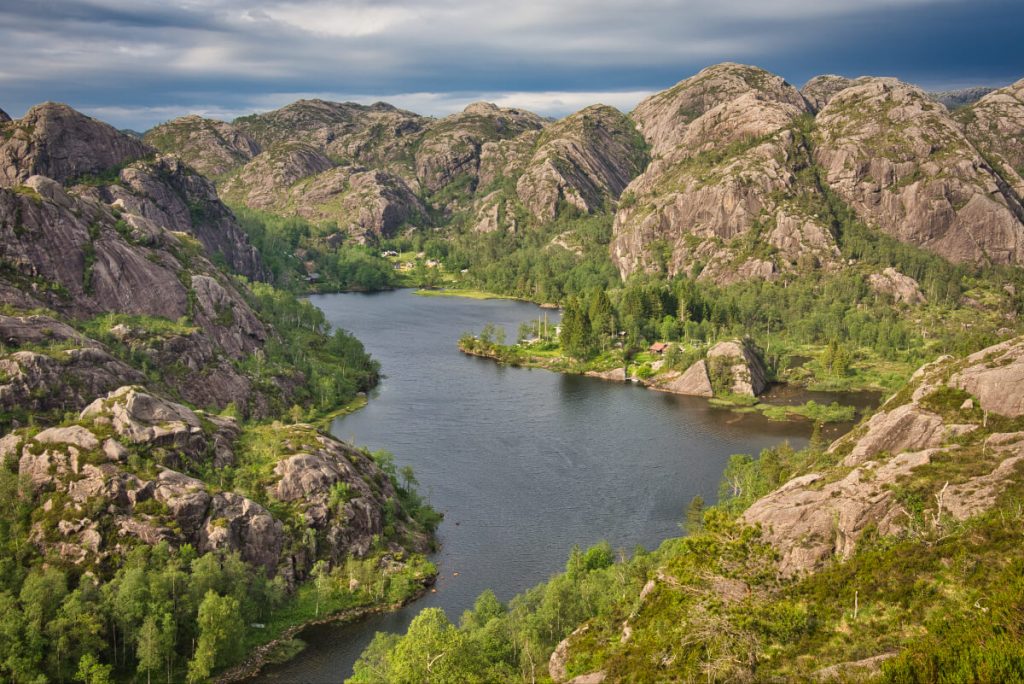
This stretch of the road follows the southern coast of Norway and connects the cities of Kristiansand and Haugesund. It is just about 400 km long so you can drive it in a day. But we think it would be a shame because the region has a lot to offer. We spent 8 days on the road and we still think it was too little to do everything we wanted.
The landscape along the way is full of contrasts. You will drive along idyllic fjords and picturesque villages with white wooden houses. Between Flekkefjord and Egersund you will get a chance to explore the moonlike landscape created by magma about 930 million years ago. And just a stone throw away from there are white sandy beaches that can compete with the tropical ones. At least visually. The water temperature is pretty chilly even during the summer.
We drove the North Sea Route in the direction from Haugesund to Kristiansand. However, in this article, we will describe it in the opposite direction because most of you will probably arrive at Kristiansand by ferry from Denmark and continue towards Preikestolen from there.
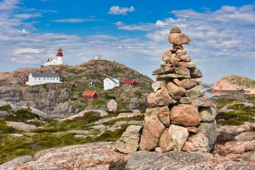
Lindesnes fyr: Norway´s oldest lighthouse
Lindesnes lighthouse that was built in 1656 is not only the oldest lighthouse in Norway but also the southernmost point of the Norwegian mainland. The distance from Lindesnes lighthouse to the northernmost point in Norway is 2518 km.
Nowadays, the complex of the buildings around the lighthouse was turned into a national lighthouse museum, that is opened every day during the summer season. The entrance costs 80 NOK for adults and 25 NOK for children. And if you want to have a very special experience, you can even spend a night in one of the houses next to the lighthouse. I would certainly love that, especially during some winter stormy night.
The lighthouse is surrounded by a beautiful rocky landscape with many possibilities for hiking. We would absolutely recommend spending some time walking around and enjoying the views of the rugged coast.
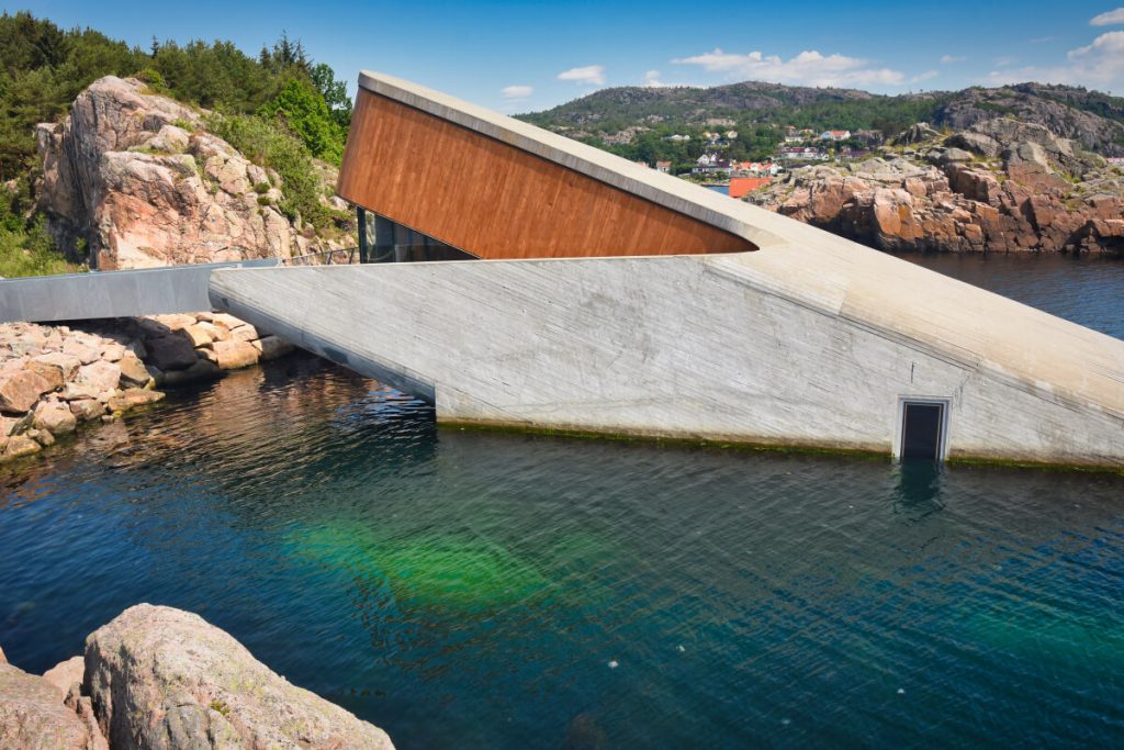
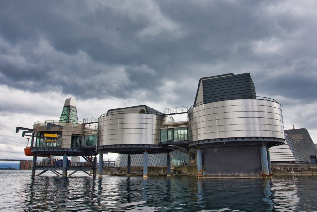
Another interesting landmark that you can visit in Lindesnes is the world’s first underwater restaurant UNDER. It was designed by famous Norwegian architectonical studio Snøhetta that is behind projects like Oslo opera house, Tverrfjellhytta in Dovrefjell National Park, or the world´s first energy-positive hotel Svart at the foot of Svartisen glacier.
We only saw the restaurant from the outside, since it is totally out of our budget. Menu in Under costs 2,250 NOK (225 EURO).
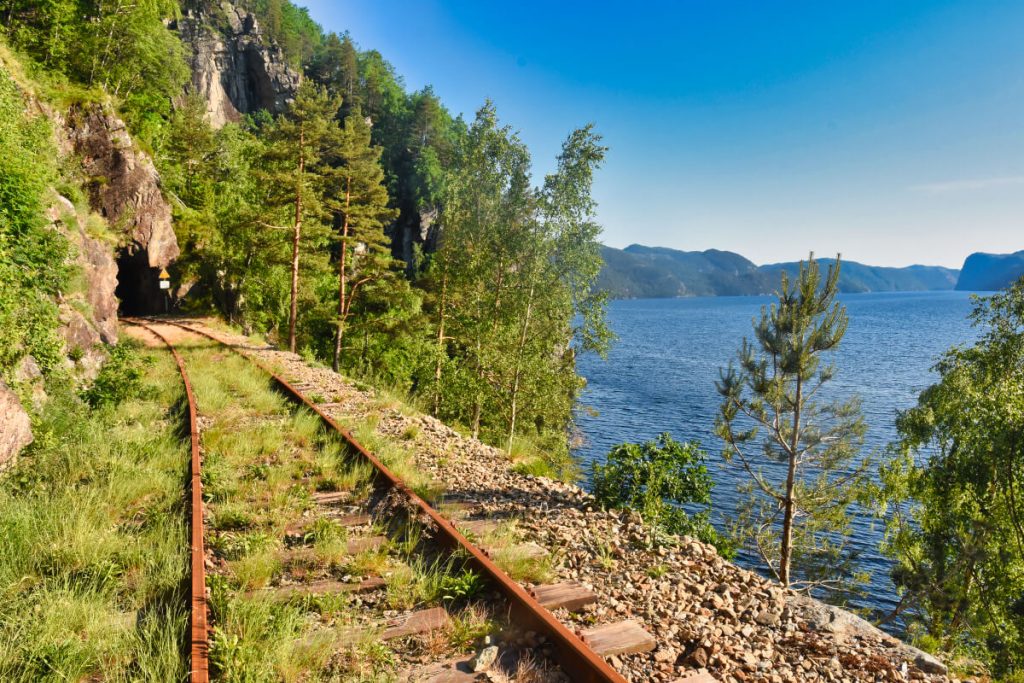
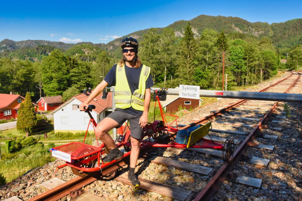
Railway biking in Flekkefjord
I wanted to try railway biking ever since I saw it in an old Czech movie when I was a small kid. When I found out that we can do it in Flekkefjord I was thrilled. The 17km long railway called Flekkefjordbanen connected Flekkefjord town with the south Norway rail link, Sørlandsbanen. The railway opened in 1904 and was in use until 1990.
Railway biking was so much fun. Even though the biking starts in Flekkefjord, right after the first tunnel you are out of the town and you can enjoy the beautiful scenery along the way. Altogether you will pass through 17 tunnels, the longest of them being Ravnejuvet with an impressive length of 1,174 meters. When you reach the end in Sira station, you simply turn the bike around and cycle the same way back.
Don´t be worry that you will crash into other railway bikers on the way back. The departures are twice a day during the summer season and you are not allowed to turn back until a certain time. The whole trip takes about 3 – 4 hours and it is suitable for any age category. Flekkefjordbanen operates from the beginning of June til the end of September and you pay 600 NOK per bike.
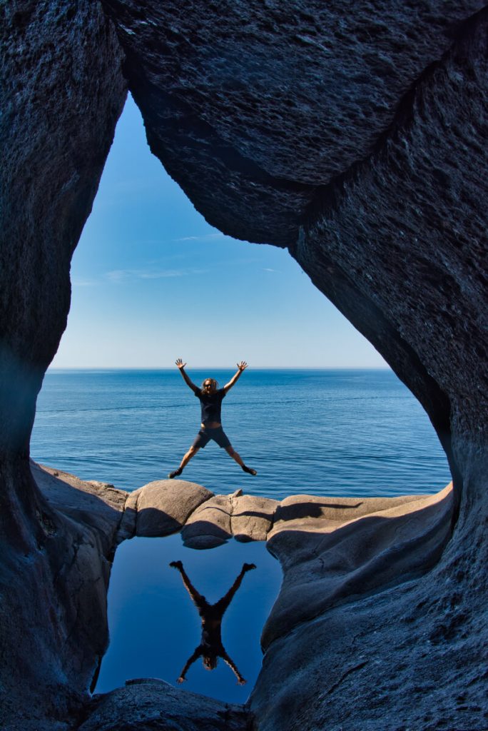
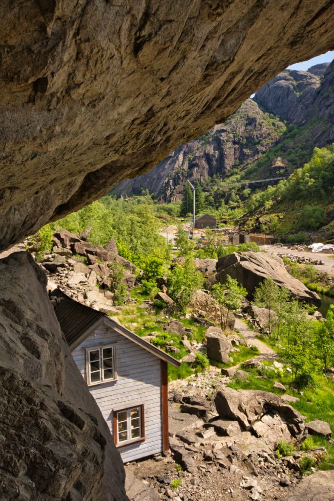
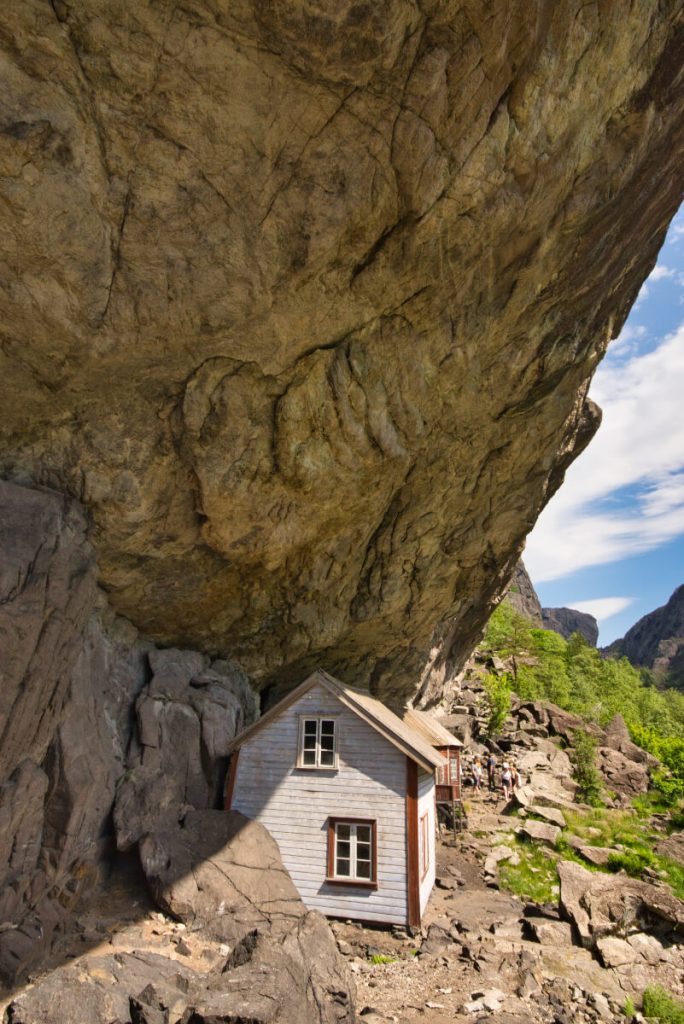
Brufjell Caves and Potholes
These amazing rock formations are located close to the village Åna-Sira about 20 km from Flekkefjord. Brufjellhålene is a set of caves and potholes shaped in the last part of the Ice Age some 20,000 years ago.
The 3-hour long hike to the caves offers beautiful views to the ocean. However, the last descend is challenging and requires some scrambling and easy climbing. It is OK even for people who have a fear of heights like me but I would not recommend climbing down with small kids or dogs. It can be also quite dangerous when it is wet so plan the hike for the summer months during a day with nice weather.

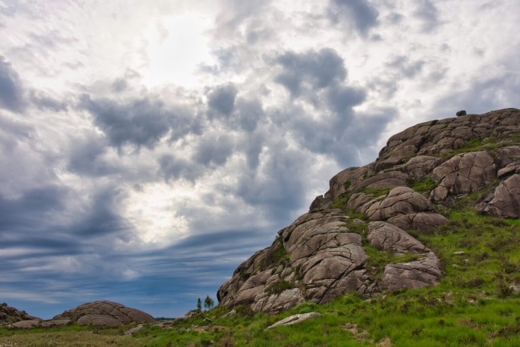
Endless possibilities for hiking in Magma Geopark
The Magma Geopark has its office in Egersund, but it has an area of 2,329 km² stretching from Flekkefjord on the east to Egersund in the west and Byrkjedal in the north.
The area is enlisted on the UNESCO list for its geological importance. The landscape in the geopark was created about 930 million years ago when magma solidified in the form of anorthosite. That is quite an unusual rock that is not very often found on Earth but interestingly it constitutes the light-colored areas of the Moon´s surface.
There are many possibilities for hiking in the Geopark. Perhaps the most famous hike is to the rock known as Trollpikken (Troll´s dick) that I will write more about later. We especially loved the area around Jøssingfjord, where we climbed the via Ferrata Migaren. We were keen on hiking the Hellersheia and Kolboltn but the weather was so hot that we chose to explore some abandoned mines in the area to cool down. You will find a nice map with all the places you can visit in the area on the Magma Geopark webpages.
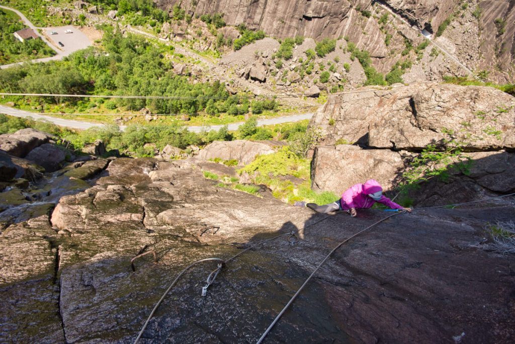
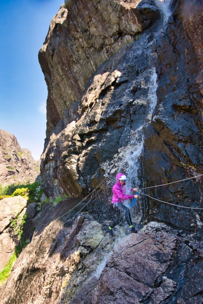
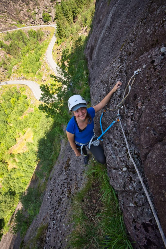
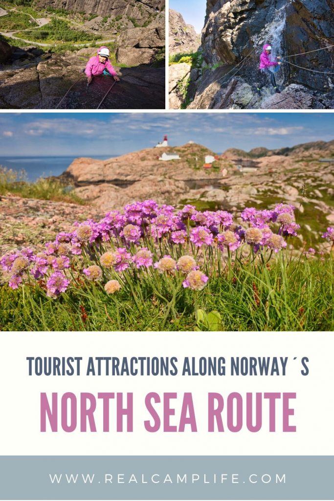
Via Ferrata Migaren in Jøssingfjord
I have always wanted to try some Via Ferrata. But I wanted to start with something very easy at the beginning because as I have mentioned before I am afraid of heights. Two years ago we were looking at climbing via Ferrata in Loen but I chickened out.
When we found out that there is a pretty easy via Ferrata in Jøssingfjord we were in. Most of the time, it is more about walking than climbing which is great for learning how to clip in the carabines for protection. The most exciting section is when you pass through a small waterfall on an exposed rock face. I was worried about how I will do in this part but when we came there it was not as scary as I thought it would be and we both had a lot of fun.
At the end I decided to name this via Ferrata “Confidence Booster.” It was a great start and I am looking forward to trying some slightly more challenging via Ferratas this summer. You can rent the equipment for via Ferrata Migaren in Egersund. It costs 300 NOK per person if you want to climb on your own. Guided tours are also possible.
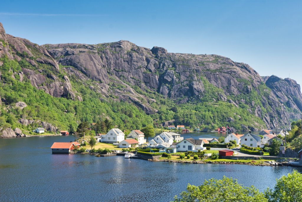
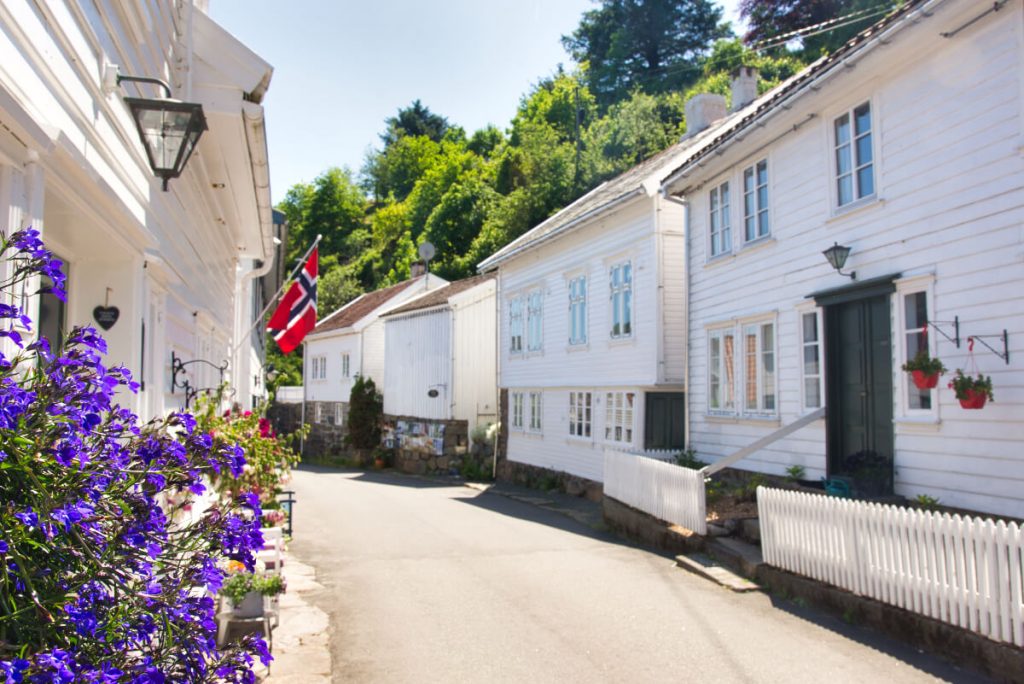
Sogndalstrand: Pictoresque village with wooden houses from the 1700s
Sogndalstrand is one of those villages that look like from a travel catalog. It is full of white painted wooden houses from the 1700s and 1800s.
I really appreciated that there is a free parking place at the entrance to the village and that the streets are cars free. We bought icecream in one of the small shops and enjoyed it on the pier with a view of the ocean and the estuary of the river Sokno, which is famous for salmon fishing.
During our trip on the North Sea Route, we were camping but I certainly would not mind staying overnight in Sogndalstrand.
Abandoned Mines in the surroundings of Egersund
During the 18th and 19th century mining was the predominant industry in the area of nowadays Magma Geopark.
We visited the area around Blåfjell that was an active ilmenite mine between 1863 and 1876. The mineral ilmenite is the main source of titanium dioxide that is used in paints, fabrics, sunscreen, or other cosmetics or even as a food coloring known as E171. The Blåfjell mountain reminded us of an Emmental cheese. The mining was conducted on three different levels and each level has several entrances. Sadly, all of them are closed for the public and it is possible to visit the mines only with a guided tour.
Nevertheless, it is still worth visiting the area as it is located away from the main road and it is surrounded by beautiful nature. Plus you will pass another interesting tourist attraction on the way to the mines – Ruggesteinen is a 74 tons heavy stone that you can try to rock using just your arm strength. It is a lot of fun!
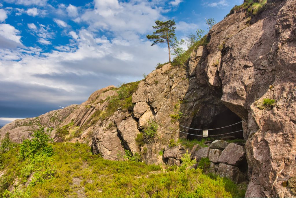
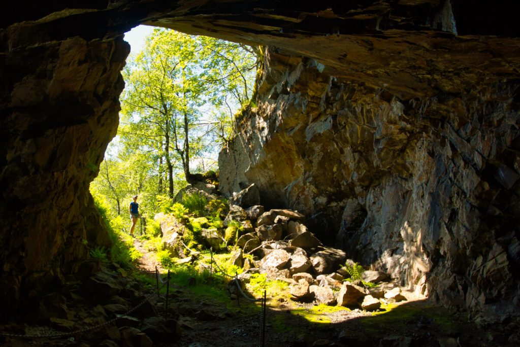
On the next day, we went for a hike to the old molybdenum mines in Gursli. They were operational between 1915 and 1919. During that time there was a high demand to supply molybdenum for steel production during World War I. The mine is closed for the public but there is a part of the hiking trail that takes you through a huge cave with several entrances to the mines. That was impressive!
You can continue the same way back or climb up to a plateau which we did. We had excellent views of the rocky landscape in the Geopark and we even took a swim in one of the many small lakes there. This three hours walk was lovely and very quiet. We did not meet a single person on this trip.
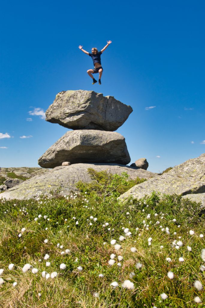
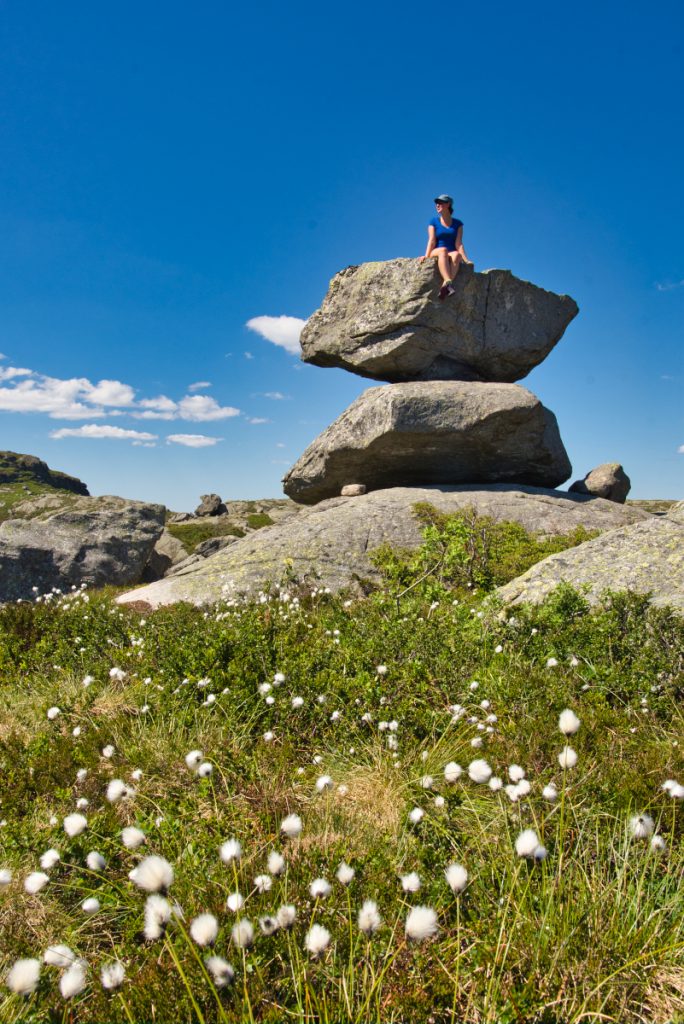
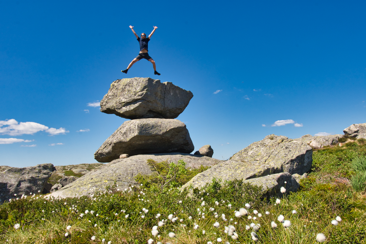
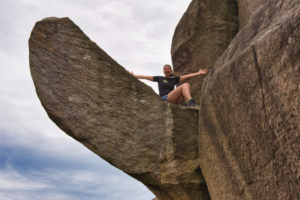
Trollpikken: Famous rock in the shape of a penis
Trollpikken alias Troll´s penis a funny shaped rock that was formed during the last Ice Age about 10.000 years ago. Until about three years ago it was relatively unknown. But one morning in June 2017 it was discovered that somebody chopped the 10 tonnes rock off. It was outrageous!
Soon after a crowdfunding campaign to re-erect the Troll´s penis started. The goal to collect 200,000 NOK (20,000 EURO) was met in no time and Trollpikken was reattached only 14 days after it was vandalized. The 2 hours return hike to Troll´s penis is very easy and the landscape around it is stunning.
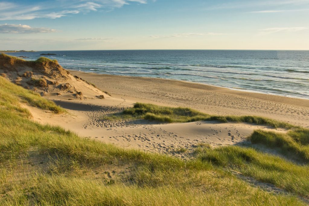
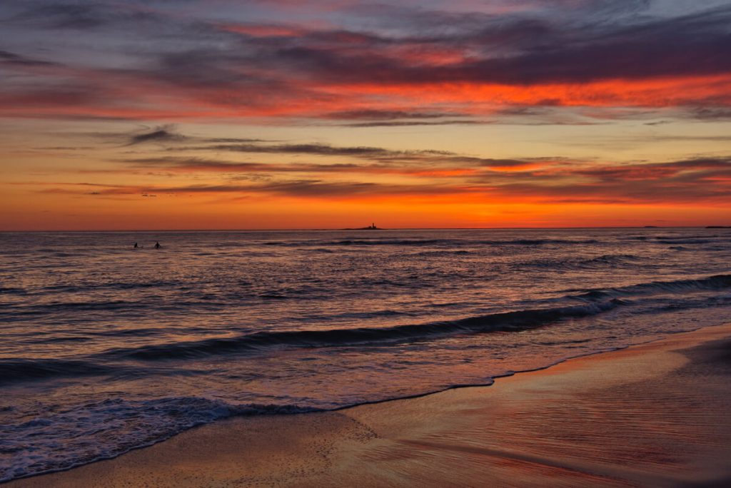
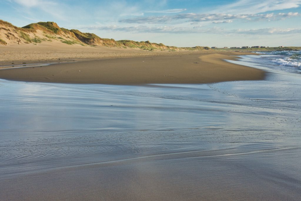
White sandy beaches along Norwegian Scenic Route Jæren
The landscape around Jæren doesn`t fit my image of Norway at all. You leave the rocky and hilly landscape behind and enter a flat agricultural area with mild climate.
The biggest attraction along the Norwegian Scenic Route Jæren is the 70 km long stretch of white sandy beaches. We spent a night camping at Borestranda while watching surfers catching the waves during the late sunset. If you want to try surfing yourself it costs only 350 NOK for 2 hours with an instructor (including the equipment!). Maybe next time we are there?
Stavanger: The oil capital of Norway
When Norway discovered North Sea oilfields in 1965, Stavanger became the base of the oil exploration which earned it a nickname “the oil capital of Norway”. There are several tourist attractions like the wooden houses from the 18th century in Old Stavanger or the monument Sverd i fjell with 3 vast swords that commemorate the historic Battle of Hafrsfjord in 872, when King Harald Fairhair gathered all of Norway under one crown.
As we have visited Stavanger a couple of times before, we have already seen these places. This time we were thrilled (or I was thrilled to be more precise) to visit the Norwegian Petroleum museum. I have heard and read very good reviews about it and was trying to persuade Ivar to go there for at least last 2 years. Sadly there were some limitations in the exhibitions due to the Covid-19 and I was a bit dissapointed.
The museum is open daily and the entrance costs 150 NOK for adults and 75 NOK for children.
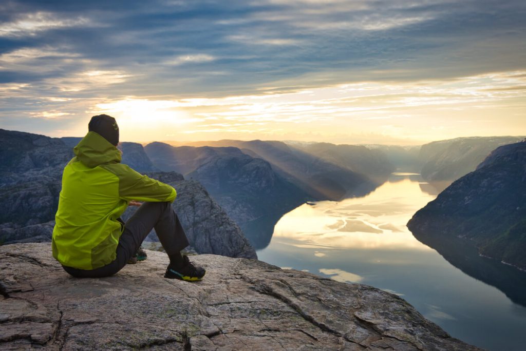
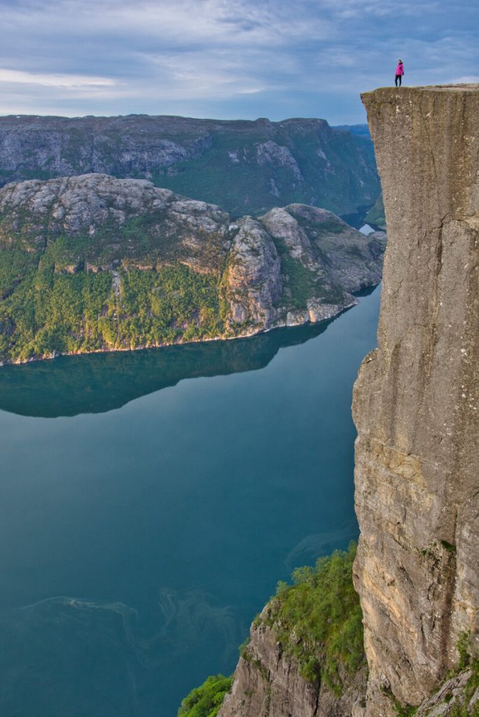
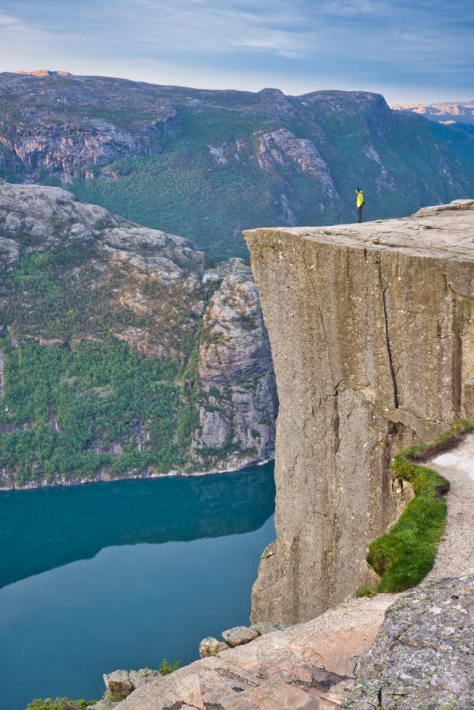
Hiking to Preikestolen (Pulpit rock)
Preikestolen is one of Norway´s most visited natural attractions. It is a square rock platform of about 25 x 25 meters that towers 600 meters above the Lysefjorden. Like many other natural attractions in this area, it was shaped during the Ice Age about 10,000 years ago.
The hike to Preikestolen is not particularly difficult if you do not underestimate your abilities, equipment, and weather conditions. The return trip from the parking place at Preikestolhytta takes about 4 hours and the altitude difference is about 350 meters.
Read more: 15 Best Day Hikes in Southern Norway
Suggested 7 days itinerary along the North Sea Route
Day 1: Visiting the lighthouse in Lindesnes, Rail biking on Flekkefjordbanen, accommodation in Flekkefjord
Day 2: Hiking to the Brufjell Potholes, Walk to Helleren in Jøssingfjord, accommodation in Sogndalstrand
Day 3: Hiking in Jøssingfjord (Hellersheia) or Via Ferrata Migaren, trip to the Blåfjell mines, accommodation in Sogndalstrand
Day 4: Hiking to Gursli mines close to Moi, accommodation in Egersund
Day 5: Coasteering adventure in Egersund (only on Sundays), hiking to Troll´s penis, catching sunset at Borestranda beach, accommodation at Borestranda beach
Day 6: Visiting Stavanger, accommodation in Stavanger
Day 7: Hiking to Preikestolen, accommodation in Stavanger
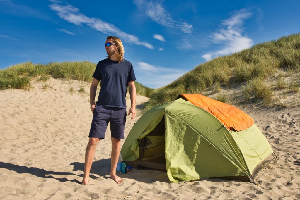
Wild camping in Norway
Thanks to a law called Allemansretten (The right to roam) wild camping is allowed in Norway. In general, you can camp pretty much anywhere, as long as it is more than 150 metres (500 feet) of an inhabited house or cabin.
If you plan to camp in open country in the lowlands, then you should not camp at the same spot for more than 48 hours without prior permission from the landowner. In the mountains and other remote, sparsely populated areas, you may camp for longer than 48 hours.
Read more about the rules for wild camping and sleeping in a car in Norway
Please always exercise the Leave No Trace principles!
- Plan ahead and prepare
- Travel and camp on durable surfaces
- Dispose the waste properly
- Leave what you find
- Minimize campfire impacts (Making open fire is forbidden in Norway between April 15 – September 15)
- Respect Wildlife
- Be considerate of other visitors
Are you planning a trip to Norway? Check our Norway Travel Guide!
READ MORE:
QUESTIONS ABOUT TRAVELING TO NORWAY?
Ask us in the comment section under the article or join our FB group Norway: Tips for travelers.
DID YOU LIKE THE POST? Pin It!
Related posts
 The Best Thing About Spring in Norway? Fruit Blossoming in Hardanger!
I have always loved spring in Norway. No, not the time when you think that…
- Skageflå Mountain Farm: The Most Beautiful Hike in Geirangerfjord
Norway has many beautiful places and even more amazing hiking possibilities. Therefore it was not…
- 40 Best Photos From Norway to Inspire Your Next Trip
For the last two years, we were trying to work as much as we could…

One response to “The North Sea Route: Hidden Gem on the Southern Coast of Norway”
My heart goes out to you, for being caught in the pandemic and finally making it back to Europe! It all sounds awful. I have always had the dream to drive from Alaska to the tip of South America and hoped to follow your blog! But if this reaches you, and if you can continue your adventure, please know that I will welcome you in Alaska!
I hope you can respond but good luck in any case.
Kristin in Alaska